Menorca's beaches get the photos, but the island is dense with older things. Its countryside is scattered with prehistoric stone monuments that UNESCO listed in 2023; its two towns grew up around harbours that Romans, Ottomans, the British and the French all fought over; and its own breed of black horse still leads the biggest festival of the year.
This is the short version — what the stones are, why the ports mattered, where the horses come in — and where to see each of them today. Dates are checked against UNESCO, the island council and the other sources listed at the bottom.
Talayots, taulas and navetas: the stone island
From around 1600 BCE until the Roman conquest in 123 BCE, the people of Menorca built in what archaeologists call cyclopean style: huge blocks of stone, stacked without mortar. In 2023 UNESCO inscribed nine groups of these sites as 'Talayotic Menorca', singling out how many there are and how well they have survived — and they really are everywhere, in fields you drive past without noticing.
Three shapes are worth learning. Talayots, the large truncated stone cones that gave the culture its name. Taulas — a tall slab capped by a second one to form a giant T, standing inside a walled enclosure — which UNESCO describes as religious structures. And navetas, burial buildings shaped like an upturned boat. Taulas and navetas are found only on Menorca. Many sites are also aligned to the sky and within sight of one another, which suggests networks whose meaning archaeologists still argue about.
Three ancient ports, and why everyone wanted Maó
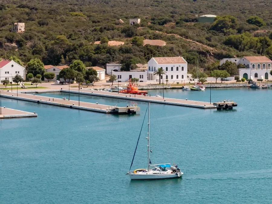
When Pliny the Elder described the island in the 1st century AD, he listed three towns: Iamo, Mago and Sanisera — today's Ciutadella, Maó and the ruins at Sanitja on the north coast. Tradition names Maó after the Carthaginian general Mago Barca, Hannibal's brother, said to have sheltered there in 205 BC; treat that as a good story rather than settled fact. Sanisera, beside Cap de Cavalleria, began as a Roman military camp in 123 BC, the year Quintus Caecilius Metellus took the island, and archaeologists are still digging there.
Maó's harbour is what made the island worth fighting over: a natural inlet about 5 km long and up to 900 m wide. It also made the island a target. Barbarossa's fleet sacked Maó in 1535, and in 1558 an Ottoman fleet besieged Ciutadella for eight days and carried its surviving inhabitants off into slavery — a disaster the town still marks every 9 July. Britain took Menorca in 1708, held it for most of the 18th century between French and Spanish interruptions, and moved the capital from Ciutadella to Maó in 1722. The island went back to Spain for good in 1802.
Black horses, and a path named after them
The Menorquín is the island's own breed: always black — horses of any other colour can't be registered — and officially recognised as a native Spanish breed in 1989. It isn't common; the recorded population was just under 3,000 in 2011, almost all of them in the Balearics. You'll see them in paddocks across the countryside, and ridden in the local dressage style, doma menorquina.
They give their name to the Camí de Cavalls — 'the horses' path' — which runs 185 km around the coast. It was most likely built to link the island's watchtowers and forts so that mounted soldiers could patrol the shore. Who built it first is disputed, with theories running from the 14th century to the French occupation in the 18th. Today it is a public walking trail in 20 stages, managed by the island council.
The horses' big moment is Sant Joan in Ciutadella, on 23 and 24 June. More than a hundred riders, the caixers, ride through the town in traditional dress, and in the jaleo the horses rear up on their hind legs in the middle of a packed crowd while a band plays. It's exhilarating and not risk-free: stay at the edge with children, and if you want to stay in Ciutadella for it, book early.
Where to see it today
- Naveta des Tudons — the best-known naveta, just off the main road east of Ciutadella — an easy stop on the way to or from the town.
- Torre d'en Galmés — a large Talayotic village site near Alaior, with talayots, a taula enclosure and the remains of houses.
- Stone sites on private land — the featured 4x4 tour from Fornells stops at prehistoric monuments on farmland you can't otherwise reach; the route varies, so don't book it for one particular site.
- Maó harbour — the harbour is the reason the British moved the capital here; the private Mahón & surroundings tour below takes you along it and around the old town. See the Mahón tour
- Cap de Cavalleria and Sanitja — the north-coast boat trip from Fornells passes the cape, next to the old Roman port. See the north-coast trip
- Sant Joan — Ciutadella, 23–24 June, with events from the Sunday before.
If you only have time for one trip on the water: 4x4 island tour with a farm cheese stop.
Booking links are affiliate links — we may earn a commission, at no extra cost to you.
What people ask before they go
What is a taula in Menorca?
A T-shaped prehistoric monument: a tall stone slab topped by a second, horizontal one, standing inside an enclosure. UNESCO describes taula enclosures as religious structures and lists taulas among the building types found only on Menorca.
When did Talayotic Menorca become a World Heritage Site?
In 2023. UNESCO's 'Talayotic Menorca' covers nine component sites with structures dating from about 1600 BCE to 123 BCE, the year of the Roman conquest.
Why is Maó the capital of Menorca and not Ciutadella?
Because of the British. Ciutadella had been the capital for centuries, but during British rule the capital moved to Maó in 1722 for its large natural harbour, and it has stayed there.
Sources we checked
- Talayotic Menorca — UNESCO World Heritage Centre — dates, site types, 2023 inscription
- Camí de Cavalls — Consell Insular de Menorca — length and stages
- Menorca — Wikipedia — British period, capital move
- Mahón — Wikipedia — harbour size, origin of the name
- Sanisera — Wikipedia — the Roman port at Sanitja
- Raid of the Balearic islands (1558) — Wikipedia — the siege of Ciutadella
- Menorquín horse — Wikipedia — breed standard and numbers
- Camí de Cavalls — Wikipedia — theories on the path's origin
- Sant Joan de Ciutadella — Illes Balears tourism — festival dates and the jaleo